
The federal government has commenced the plotting of the disputed and newly drilled oil and gas wells in the oil-producing states in the Niger Delta.
The exercise is to minimize misunderstanding and disputes among the oil-producing states over the location and ownership of oil wells and the accruing revenue.

The Revenue Mobilisation Allocation and Fiscal Commission (RMAFC) is in charge of the exercise.
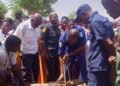
A statement on Tuesday by the Head, Information and Public Relations Unit, RMAFC, Maryam Yusuf, quoted the Chairman of the commission, Mohammed Shehu while flagging off the exercise as saying the inter-agency technical committee which was inaugurated by the RMAFC to verify the coordinates of the disputed and newly drilled oil and gas wells had completed the exercise and the next step is the plotting of the coordinates.
Shehu said the exercise was necessary to ensure that oil-producing states receive their rightful share of the revenue in line with the constitution.
“The constitution provides that 13 percent of revenue from minerals, especially crude oil and gas, should be paid to the states where they are produced.
Read Also:
- FG inaugurates high level committee to reform textbook approval, tackle rising education costs
- FG, Islamic bank launch bilingual school in Kano
- FG opens applications for 2026 PTDF overseas scholarships
“This is why the verification and plotting of coordinates of the new and disputed oil and gas wells is not optional, but a constitutional obligation,” he said.
According to Shehu, the exercise cuts across all oil-producing states, including Akwa Ibom, Cross River, Bayelsa, Ondo, Rivers, Delta, and offshore locations.
He observed that disputes often arise whenever new oil fields come on stream, as multiple states may lay claim to them.
However, he stressed that it is the facts on the ground that will reveal who actually owns what, and if ownership has to be shared between states.
To guarantee transparency and credibility, the chairman disclosed that the commission undertook extensive fieldwork between September 2025 and January 2026, covering creeks, high seas, and offshore terrains in the company of the surveyors-generals of the affected states throughout the exercise.
“We went to the field ourselves, and where we could not physically access, we deployed drones to take the coordinates,” he said, adding that all data collected was witnessed by representatives of the affected states.
He assured stakeholders that the commission would remain impartial throughout the process, expressing confidence that the outcome of the exercise would significantly reduce disputes and strengthen trust in the derivation process.

