


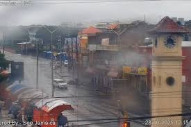
Hurricane Isaias made landfall near Destin on Florida’s Panhandle on Friday evening as a Category 2 storm, unleashing destructive winds, life-threatening storm surges and heavy rainfall along the northern Gulf Coast.
The hurricane threatened coastal communities with flooding, power outages and possible tornadoes, prompting emergency declarations and warnings across Florida, Alabama and Georgia as dangerous conditions extended inland.

Key Highlights
- Hurricane Isaias made landfall near Destin, Florida, on October 9, 2026, as a Category 2 hurricane.
- The storm had maximum sustained winds of 105 mph (165 km/h) at landfall.
- A weather station near Santa Rosa Sound recorded a 116 mph wind gust.
- Forecasters warned of 4 to 8 inches of rainfall, with locally higher totals possible.
- Hurricane-force winds, flash flooding and tornadoes remained potential threats as the storm moved inland.
- States of emergency were in effect in Florida, Alabama and Georgia, while widespread power outages were reported.
Hurricane Isaias Hits Florida Panhandle Near Destin
Hurricane Isaias came ashore near Destin at approximately 8:30 p.m. Central Daylight Time on Friday, October 9, according to National Hurricane Center radar data.
At landfall, the storm recorded maximum sustained winds of 105 mph (165 km/h) and a minimum central pressure of approximately 971 millibars.
Isaias was described as the first hurricane of the 2026 Atlantic hurricane season. It had strengthened to Category 3 earlier on Friday before weakening to Category 2 as it approached the Florida coast.
The storm struck a stretch of barrier islands and coastal communities where evacuation orders had been issued, raising concerns about storm surge, structural damage and dangerous coastal conditions.
Storm Surge and Powerful Winds Threaten Coastal Communities
Hurricane Isaias brought powerful winds and elevated water levels to parts of Florida’s Gulf Coast.
A National Oceanic and Atmospheric Administration water-level gauge in Panama City Beach reportedly measured a water level of 5.6 feet above mean higher high water.
A WeatherFlow station near Santa Rosa Sound recorded a wind gust of 116 mph and sustained winds of 91 mph, while another station near Pensacola recorded a gust of 100 mph.
The measurements highlighted the potential for significant damage to buildings, trees, power infrastructure and coastal roads.
Authorities warned residents in affected areas to remain in secure locations and follow official emergency instructions as the storm’s strongest winds and coastal flooding threatened communities.
Hurricane Isaias Weakens After Landfall
Following landfall, Isaias began weakening as wind shear disrupted the storm’s structure.
By late Friday night, the National Hurricane Center had downgraded its intensity and forecast that it could become post-tropical within approximately 12 hours as it moved north through Alabama.
However, weakening winds did not eliminate the danger. Hurricane warnings remained in effect for parts of Florida’s Panhandle and southern Alabama, while storm-surge warnings covered areas from Dauphin Island, Alabama, to Suwannee, Florida.
Forecasters cautioned that hazardous conditions could continue after the centre of the storm moved inland.
Heavy Rainfall Raises Flash-Flood Risk in Alabama and Georgia
Rainfall posed a major threat as Hurricane Isaias moved away from the coast.
Forecasts called for between 4 and 8 inches of rain across Florida’s Panhandle, southern Alabama, the Big Bend region and southwest Georgia, with locally higher totals possible.
Such rainfall could overwhelm drainage systems, flood roads and trigger flash flooding, particularly in low-lying areas and locations already saturated by earlier rain.
Forecasters also warned that hurricane-force winds could extend as far as 100 miles inland across southern Alabama, potentially causing additional damage and disrupting electricity supplies.
Tornadoes remained possible east of the storm’s centre, especially across the Florida Panhandle and southern Georgia, with the threat expected to spread north-northeast on Saturday.
Read also:
- Hurricane Isaias Nears Northern Gulf Coast as Florida Declares Emergency in 25 Counties
- Hurricane leaves a trail of destruction across the Caribbean
- Trump Approves Emergency Declarations for Florida, Alabama as Hurricane Isaias Hits Gulf Coast
t
Emergency Declarations as Power Outages Spread
States of emergency were in effect in Florida, Alabama and Georgia as officials responded to the hurricane’s impact.
Hundreds of thousands of electricity customers reportedly lost power as trees fell and coastal highways experienced flooding.
Emergency officials urged residents in warning areas to remain in safe rooms, avoid flooded roads and prepare for potentially prolonged power outages.
The storm’s movement inland also raised concerns about communities outside the immediate coastal impact zone, where strong winds, falling trees, flooding and possible tornadoes could create additional hazards.
Isaias Threat Extends Beyond Florida Coast
Although Hurricane Isaias began weakening after making landfall, forecasters warned that dangerous weather could persist across parts of the southeastern United States.
The combination of heavy rainfall, strong winds, storm surge and possible tornadoes created multiple hazards for residents and emergency responders.
Authorities continued to urge people in affected areas to monitor official weather alerts and follow evacuation and safety instructions as the storm moved inland.
For more global news, follow us on X.